Hello!
I’m new to GMT and PyGMT, and I’m trying to create a GeoTIFF export of a bathymetry dataset.
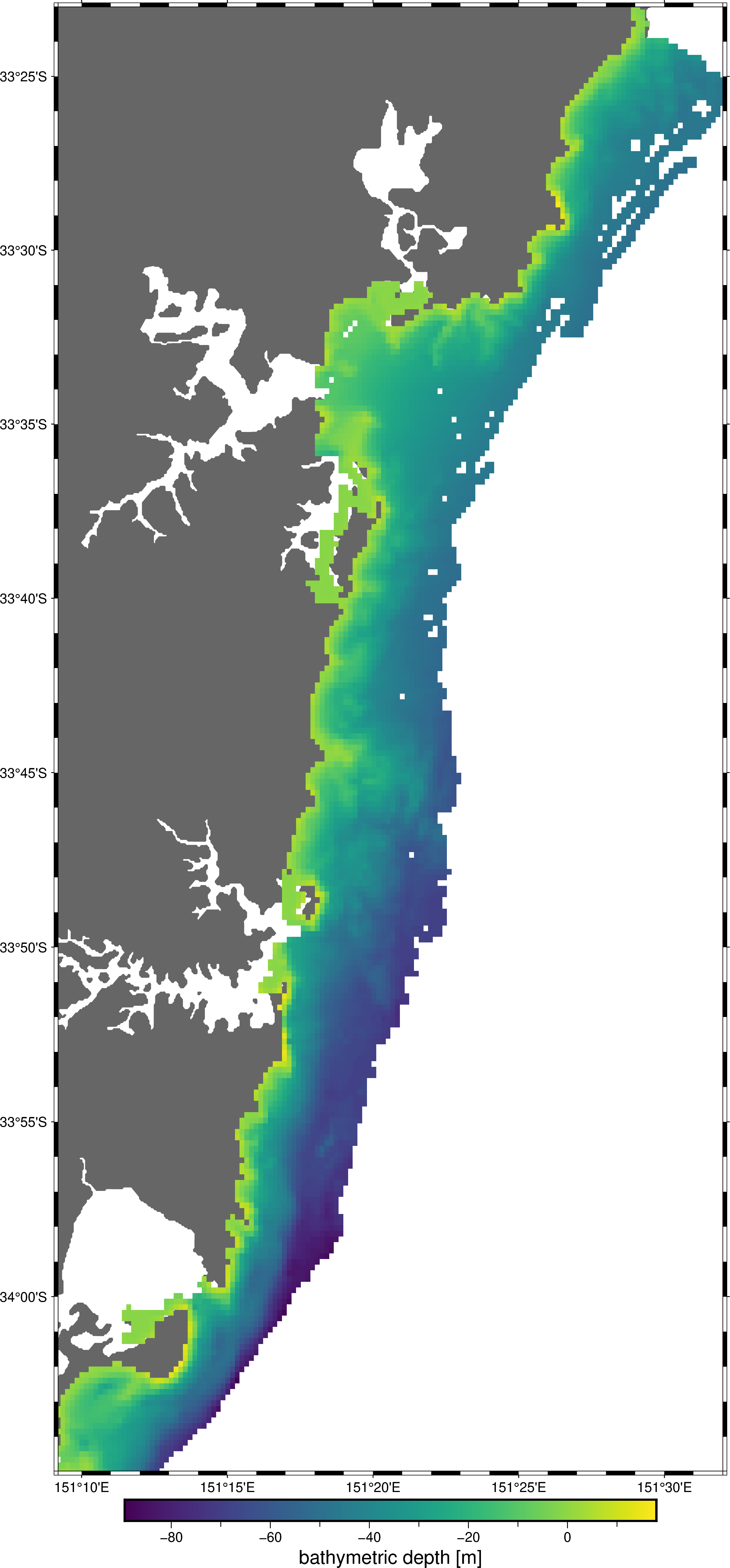
I can plot the data just fine as follows:
fig = pygmt.Figure()
fig.coast(region=region, projection="M20c", land="#666666")
fig.grdimage(
    grid=grid.bathymetry,
    cmap="viridis",
    nan_transparent=True,
    # img_out="out.tif",
)
fig.basemap(frame=True)
fig.colorbar(frame='af+l"bathymetric depth [m]"')
fig.show()
But when I try to use the out_image parameter to write a GeoTIFF file with
fig = pygmt.Figure()
fig.grdimage(
    grid=grid.bathymetry,
    cmap="viridis",
    nan_transparent=True,
    img_out="out.tif",
)
I get the following error:
grdimage [ERROR]: Option -A: No output argument allowed
grdimage [ERROR]: Option -A: Must provide an output filename for image
---------------------------------------------------------------------------
GMTCLibError                              Traceback (most recent call last)
Cell In[194], line 3
      1 fig = pygmt.Figure()
      2 # fig.coast(region=region, projection="M20c", land="#666666")
----> 3 fig.grdimage(
      4     grid=grid.bathymetry,
      5     cmap="viridis",
      6     nan_transparent=True,
      7     img_out="out.tif",
      8 )
      9 # fig.basemap(frame=True)
     10 # fig.colorbar(frame='af+l"bathymetric depth [m]"')
     11 # fig.show()
     12 # fig.savefig('out.tif')

File /opt/conda/envs/pygeo/lib/python3.11/site-packages/pygmt/helpers/decorators.py:598, in use_alias.<locals>.alias_decorator.<locals>.new_module(*args, **kwargs)
    591     msg = (
    592         "Parameters 'Y' and 'yshift' are deprecated since v0.8.0. "
    593         "and will be removed in v0.12.0. "
    594         "Use Figure.shift_origin(yshift=...) instead."
    595     )
    596     warnings.warn(msg, category=SyntaxWarning, stacklevel=2)
--> 598 return module_func(*args, **kwargs)

File /opt/conda/envs/pygeo/lib/python3.11/site-packages/pygmt/helpers/decorators.py:738, in kwargs_to_strings.<locals>.converter.<locals>.new_module(*args, **kwargs)
    736             kwargs[arg] = separators[fmt].join(f"{item}" for item in value)
    737 # Execute the original function and return its output
--> 738 return module_func(*args, **kwargs)

File /opt/conda/envs/pygeo/lib/python3.11/site-packages/pygmt/src/grdimage.py:193, in grdimage(self, grid, **kwargs)
    190     kwargs["I"] = stack.enter_context(shading_context)
    192 fname = stack.enter_context(file_context)
--> 193 lib.call_module(
    194     module="grdimage", args=build_arg_string(kwargs, infile=fname)
    195 )

File /opt/conda/envs/pygeo/lib/python3.11/site-packages/pygmt/clib/session.py:530, in Session.call_module(self, module, args)
    526 status = c_call_module(
    527     self.session_pointer, module.encode(), mode, args.encode()
    528 )
    529 if status != 0:
--> 530     raise GMTCLibError(
    531         f"Module '{module}' failed with status code {status}:\n{self._error_message}"
    532     )

GMTCLibError: Module 'grdimage' failed with status code 72:
grdimage [ERROR]: Option -A: No output argument allowed
grdimage [ERROR]: Option -A: Must provide an output filename for image
These two errors seem to contradict each other, which is confusing. Does anyone have ideas about how to debug the issue further? Or can anyone suggest a workaround? I don’t mind using other software if it’s not currently possible with pygmt.
Thanks!
Oliver