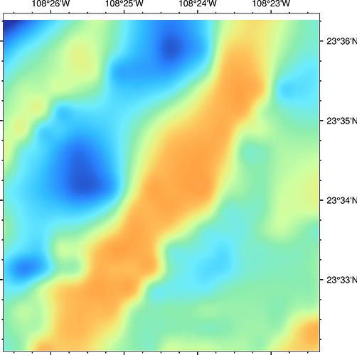
Hi, I have a little problem when I use grdimage and the @earth_relief_01s.grd and 03s to plot a particular region, it does not appear complete. I do not have this problem when I use a lower resolution earth _relief grid. The missing part is on the top of the figure below.
This is the code:
#!/usr/bin/env bash
format=“png”
output=“zona_estudio_alarcon”
RR2=“-R-108.444/-108.3724/23.53499/23.6057”
gmt begin $output $format
gmt basemap $RR2 -JM15c -B -BwsNE
gmt grdimage @earth_relief_01s.grd -Cdem.cpt -V
gmt end show
Thanks
