Dear PyGMT colleagues,
I received a message from a colleague (Ola — GitHub link here ) who is working with PyGMT and adapting the “Antarctic Peninsula 3D Maps” repository. The goal is to drape an RGB image over a bathymetric grid of the Weddell Sea using the projection=‘L-60/-65/-72/-60/15c’.
However, the final result shows the image partially clipped, and it’s unclear why.
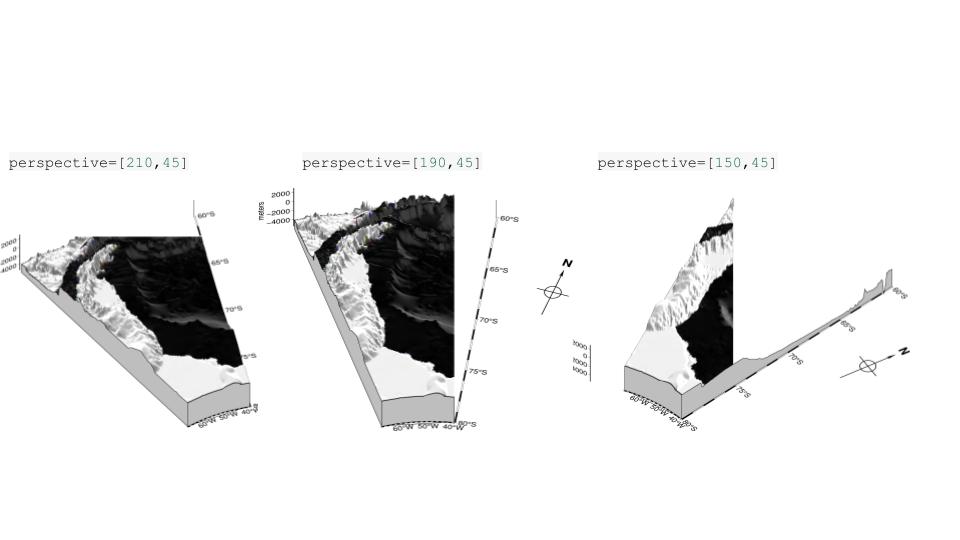
I ran several tests on my side and initially suspected the issue was related to the workflow for cropping the satellite image and aligning it with the grid. But then I realized something interesting: just by changing the perspective, the clipping changes position. This makes me believe the issue may be related to the rendering process (see image above for an example).
Does anyone have an idea of what might be causing this?
If you’re curious or want to try reproducing the problem, my notebook is available here: [link].
Thanks in advance!