Dear GMT users,
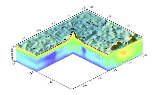
I want to plot 3d model like in the example figure. I have got separate columns for longitude-latitude-value-depth
What is the proper approach and which gmt commands should i use in order to get this model ?
Thanks in advance

Dear GMT users,
I want to plot 3d model like in the example figure. I have got separate columns for longitude-latitude-value-depth
What is the proper approach and which gmt commands should i use in order to get this model ?
Thanks in advance

I’m afraid this is not doable in GMT.
here is my solution:
It looks beautiful. After almost four years I wasn’t expecting an answer. Thank you so much : )