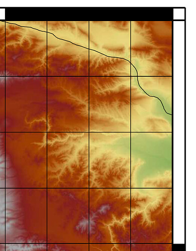
Hello,
As I managed to create my basic map (see yesterday’s post https://flint.soest.hawaii.edu/t/resampling-of-map/304), now I am starting looking into the details. I noticed that the x and y axis are not of the same scale. Have a look at the image I have attached. As you can see, 1 degree on the y axis is represented by a longer distance than 1 degree on the x axis. Can I make them equal somehow?
You chose -R34/45/36/42 -JM26 which is a Mercator projection and you are on the Northern Hemisphere between N36° and N42° – so some distortion is to be expected? Maybe you can explain a bit why you want them to be equal?
It would make the interpretation of some vectors I have added easier. For example, there is one vector that is almost parallel to the x-axis, but this distortion makes it look as if the end of vector is far higher than it should.
So you need a projection that is equally good in area as well as in angles?
Probably yes, but not being an expert with maps and projections, etc I can only guess.
Maybe give the Lambert Conic Conformal Projection a try:
-JLlon0/lat0/lat1/lat2/width
So in your case something like
-JL39/39.5/38/40/26
might do the trick. This projection is heavily used for navigation charts. If you want rectangular map borders have a look at the -R...+r option. And fiddle a bit with the corners. Be aware that the syntax switches to lower left corner and upper right corner.
Although the projection you suggested did not do what I wanted, you pointed me towards the right direction. It seems that the Cylindrical Equidistant Projection does what I need.
Thanks!
… that’s the projection we pick when we want to ignore that there is no way to put a sphere on a plane without distortions.
