Please, confirm my guess.
I found that some country border needs to correct.
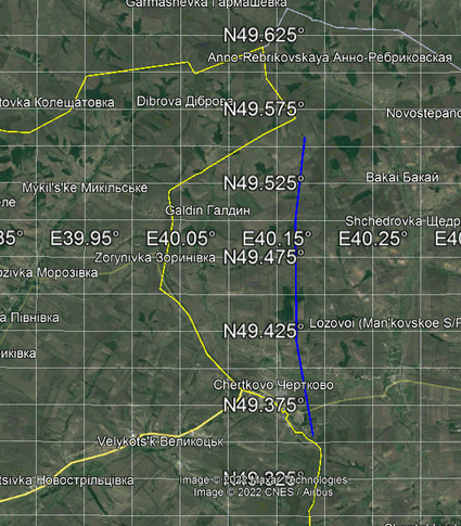
The yellow line is Goggle border and the blue line builds from points of DCW output.
I see a clear mismatch
pscoast -M -ERU.ROS >rostov0.txt
PS file shoes both two places ( Chertkovo (Rostov region) and Zoryanovka (Donetsk region)) on Donetsk region
Yes, we know that nor DCW nor GSHHG are perfect (and hardly will be corrected). But let me add too that IMO this is currently not the best area of the World to bring up to this discussion. Without knowing what’s the use of this, I’ll stop giving any further contribution.