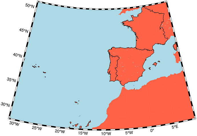
@Andreas this time I’m not teasing you.
julia> earthregions("UN")
29×4 GMTdataset{Float64, 2}
 Row │     W(lon)      E(lon)      S(lat)      N(lat)    Code              Region                Ref
     │    Float64     Float64     Float64     Float64  String              String               String
─────┼─────────────────────────────────────────────────────────────────────────────────────────────────
   1 │  -25.3587     77.6033   -50.0189     37.5439     UN002              Africa                 UN
   2 │  -17.1032     38.8493     8.67912    37.5439     UN015          Northern Africa            UN
   3 │  -25.3587     77.6033   -50.0189     27.2981     UN202        Sub-Saharan Africa           UN
   4 │   21.9994     77.6033   -50.0189     18.0031     UN014          Eastern Africa             UN
   5 │    6.47017    31.3059   -18.0421     23.4504     UN017           Middle Africa             UN
   6 │   11.7156     32.896    -34.8398    -16.9599     UN018          Southern Africa            UN
earthregions("PT,ES,FR", country=true)
More at (it can download earth_relief and friends equally easily)
https://www.generic-mapping-tools.org/GMTjl_doc/documentation/modules/earthregions/index.html#earthregions
