Error when creating a basemap with gmt basemap

Good morning dear friends,

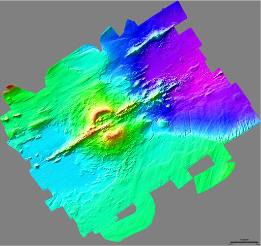
Sorry if this is a basic question, but I am trying to replicate the example 28 about mixing UTM and geographic datasets. I have managed to plot the DEM but I am not getting the mixed coordinates, could you please tell me where I am going wrong? My dem is in UTM 21S projected coordinates. Thank you in advance for your response. Attached image.

This is the script I used:


gmt begin the_axe_seamount
	# Set up a color rainbow
	gmt makecpt -Crainbow -T-1490/-290
	# Lay down the UTM topo grid using a 1:100,000 scale
	gmt grdimage the_axe_seamount.tif -I+d -Jx1:100000 --FONT_ANNOT_PRIMARY=9p
	# Overlay geographic data and coregister by using correct region and gmt projection with the same scale
	gmt coast -Rthe_axe_seamount.tif -Jutm/-21/1:100000 -Df+ -Slightblue -W0.5p -B5mg5m -BNE \
		--FONT_ANNOT_PRIMARY=12p --FORMAT_GEO_MAP=ddd:mmF
	echo 59:16:25W 62:37:54S Monte Submarino The Axe | gmt text -F+f12p,Helvetica-Bold+jCB
	gmt basemap --FONT_ANNOT_PRIMARY=9p -LjRB+c62:35S+f+w5k+l1:100,000+u+o0.5c --FONT_LABEL=10p
	# Annotate in km but append ,000m to annotations to get customized meter labels
	gmt basemap -Rthe_axe_seamount.tif+Uk -Jx1:100 -B5g5+u"@:8:000m@::" -BWSne --FONT_ANNOT_PRIMARY=10p \
		--MAP_GRID_CROSS_SIZE_PRIMARY=0.25c --FONT_LABEL=10p
gmt end show
Hard to tell without knowing what went wrong. Anyway, my personal recommendation to this type of plots is https://www.generic-mapping-tools.org/GMTjl_doc/examples/projections/ex28/#mixing_utm_and_geographic_axes_annotations

two things look obviously wrong:

  1. you need to replace -Slightblue with -Gwhite in the gmt coast call cited below. Using -Slightblue you are painting over all water including your DEM with light blue color. -Gwhite paints land white instead.
	gmt coast -Rthe_axe_seamount.tif -Jutm/-21/1:100000 -Df+ -Slightblue -W0.5p -B5mg5m -BNE \
		--FONT_ANNOT_PRIMARY=12p --FORMAT_GEO_MAP=ddd:mmF
  1. the underwater mountain label, echo 59:16:25W 62:37:54S Monte Submarino The Axe ... , the coordinates seem way off. Use something like 59:50:00S 62:47:00W to get the label close to the mountain.

In gmt coast -Rthe_axe_seamount.tif -Jutm/-21/1:100000 ... could you try -Ju-21/1:100000 instead?

Thanks Joaquim, mkononets and Esteban for answering. I was able to solve it, the problem was to remove ’ \ ’ from the script lines, for some reason it generated an error, I also replaced “-Slightblue” by “-Gwhite” and modified the coordinates as suggested by mkononets. In Julia wrapper it looks simpler, I will use it.

Thank you very much for your help, you guys are brilliant!

Best regards,

Oscar