How plot iceland map

hi guys,
i want to plot Iceland maps.

in the traditional way, the codes doens’t works.

gmt coast  -R63.78470/64.102699/-21.56111/-22.970911 -JM6i -B -Gchocolate 

These don’t work.

i use the example 3, to understand what happens.
but don’t give me a good maps.

Why? Want i do in the wrong way?

Hi, what’s your output?

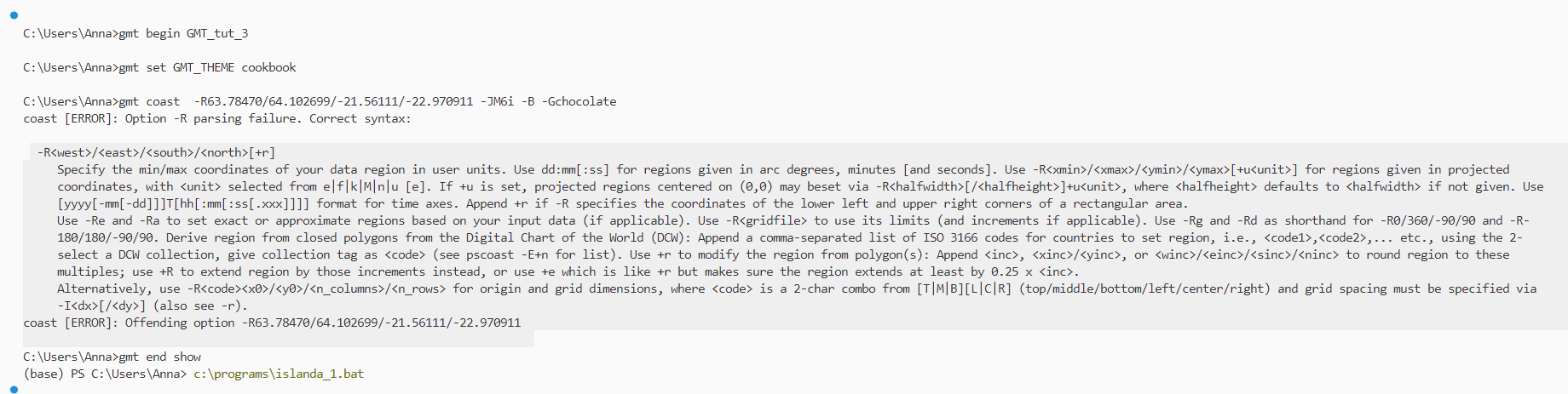
Assuming you want to plot Reykjanes peninsula: your -R specification is wrong. Correct syntax is -RW/E/S/N: -R-22.970911/-21.56111/63.78470/64.102699
then, you need to specify some output, like the following (one liner/modern mode):
gmt coast -R-22.970911/-21.56111/63.78470/64.102699 -JM6i -B -Gchocolate -png quick

EDIT OK you have the gmt begin/end lines, -png ... is not needed then.

1 Like

yeah, the syntax is from min to max val in R values

yes maybe , it is wrong the min e the max. i confus with the negative values.

Thanks you for helps!

i have another question.
for grdimage to plot @earthrelief for resolution 03s or 01s doesn’t work.
i received this error.

How can plot in the good way?

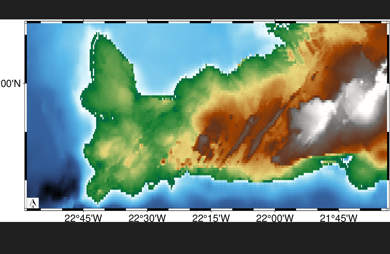
You say it does not work but your message has no error and is not even addressing @earth_relief_03s etc anyway. And you know that 0es and 01s is only overland, right, so 15s automatically fills in?


yes, this is what received with 15s. it is a bad solution

I have no idea where you are trying to map. Negative latitudes is not near Iceland. Is this the UK? Surprise to me to se Equator going through it.


iceland have negative coordinate.

That coordinates are latitude and longitude. In GMT the coordinates are reversed (LONG and LAT).

1 Like

yes thank you very much.
to plot a base map of iceland the problem is solved.

i would now like to have a high resolution earthrelief image if it is possible.

Longitude yes, but you did latitudes

yes okay.

i put in this way my codes
gmt coast -R-22.970911/-21.56111/63.78470/64.102699 -JM6i -B -Gchocolate

gmt grdimage @earth_gebco_03s -R-22.970911/-21.56111/63.78470/64.102699 

Long and lat!
i receive the basemap for iceland. but not the grdimage

It is not possible from the remote data sets. From the docs:

Note : The 3 and 1 arc second grids only extend to latitudes ±60˚ .

So, you will need to search in another source.