Hello I’m Rasta from Indonesia
I just learn PyGMT and try to make DEM from grided XYZ data.
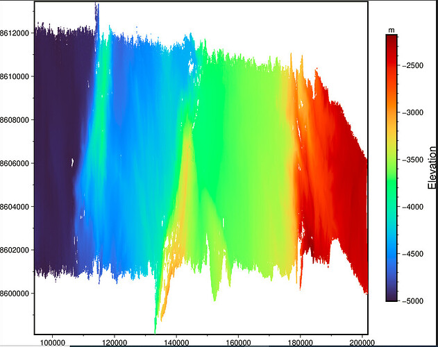
I used pygmt.surface module to create DEM, instead of getting DEM like this (this image was created using fig.plot() ):
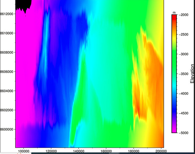
I got DEM like this :
In “basic” GMT we can use “gmt mask” to masking excess gridding data. Is this the only solution? Because i cant find this module in PyGMT. Or there is any solution to make DEM?
Thanks.

