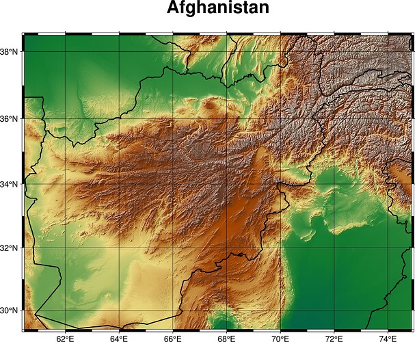
I don’t know how to make topography map. Please do guide
Hi,
Have a look at the documentation and the gallery examples.
You are interested in grdimage module to display the topography from remote dataset (@earth) and coast module to clip it on Afghan region (the code should be gmt coast -EAF ... I think).
HF GL,
gmt begin af png

gmt grdimage -Jm1:10000000 -RAF @earth_relief -I
gmt coast -Na/thick
gmt basemap -Bxafg -Byafg -B+t"Afghanistan"

gmt end show
What new users should do is to study the docs and try. We have, for example, tutorials to help the learning steps.
1 Like
Vậy nếu làm ở GMT 4.5.18 thì sao
Help make a Afghanistan Topography map on GMT 4.5.18
