Dear Gurus,
I have this GeoTiff file which loads correctly (e.g., QGIS):
Driver: GTiff/GeoTIFF
Files: pd.tif
Size is 412, 335
Coordinate System is:
GEOGCRS[“WGS 84”,
DATUM[“World Geodetic System 1984”,
ELLIPSOID[“WGS 84”,6378137,298.257223600004,
LENGTHUNIT[“metre”,1]]],
PRIMEM[“Greenwich”,0,
ANGLEUNIT[“degree”,0.0174532925199433]],
CS[ellipsoidal,2],
AXIS[“geodetic latitude (Lat)”,north,
ORDER[1],
ANGLEUNIT[“degree”,0.0174532925199433]],
AXIS[“geodetic longitude (Lon)”,east,
ORDER[2],
ANGLEUNIT[“degree”,0.0174532925199433]],
ID[“EPSG”,4326]]
Data axis to CRS axis mapping: 2,1
Origin = (-76.671879999999987,-15.647360000000001)
Pixel Size = (0.000460000000000,-0.000460000000000)
Metadata:
AREA_OR_POINT=Area
Image Structure Metadata:
INTERLEAVE=BAND
Corner Coordinates:
Upper Left ( -76.6718800, -15.6473600) ( 76d40’18.77"W, 15d38’50.50"S)
Lower Left ( -76.6718800, -15.8014600) ( 76d40’18.77"W, 15d48’ 5.26"S)
Upper Right ( -76.4823600, -15.6473600) ( 76d28’56.50"W, 15d38’50.50"S)
Lower Right ( -76.4823600, -15.8014600) ( 76d28’56.50"W, 15d48’ 5.26"S)
Center ( -76.5771200, -15.7244100) ( 76d34’37.63"W, 15d43’27.88"S)
Band 1 Block=412x4 Type=Float32, ColorInterp=Gray
Min=-3177.755 Max=-2618.255
Minimum=-3177.755, Maximum=-2618.255, Mean=-3005.988, StdDev=94.895
NoData Value=nan
Metadata:
STATISTICS_MAXIMUM=-2618.2546386719
STATISTICS_MEAN=-3005.9882169958
STATISTICS_MINIMUM=-3177.7551269531
STATISTICS_STDDEV=94.894774159749
However, for some reason after using grdgradient pd.tif -A90 -Gpd.tif.drvx -fg to start creating an intensity file (*.int), I get that this file does not have any longer the WGS84 information:
grdinfo pd.tif.drvx
pd.tif.drvx: Title: Produced by grdgradient
pd.tif.drvx: Command: grdgradient pd.tif -A90 -Gpd.tif.drvx -fg
pd.tif.drvx: Remark: Directional derivative(s)
pd.tif.drvx: Pixel node registration used [Geographic grid]
pd.tif.drvx: Grid file format: nf = GMT netCDF format (32-bit float), COARDS, CF-1.5
pd.tif.drvx: x_min: -76.67188 x_max: -76.48236 x_inc: 0.00046 name: longitude [degrees_east] n_columns: 412
pd.tif.drvx: y_min: -15.80146 y_max: -15.64736 y_inc: 0.00046 name: latitude [degrees_north] n_rows: 335
pd.tif.drvx: z_min: -0.641319692135 z_max: 0.598035931587 name: z
pd.tif.drvx: scale_factor: 1 add_offset: 0
pd.tif.drvx: format: netCDF-4 chunk_size: 138,168 shuffle: on deflation_level: 3
GEOGCS[“unknown”,
DATUM[“unknown”,
SPHEROID[“unknown”,6378137,298.257223600004]],
PRIMEM[“Greenwich”,0,
AUTHORITY[“EPSG”,“8901”]],
UNIT[“degree”,0.0174532925199433,
AUTHORITY[“EPSG”,“9122”]],
AXIS[“Longitude”,EAST],
AXIS[“Latitude”,NORTH]]
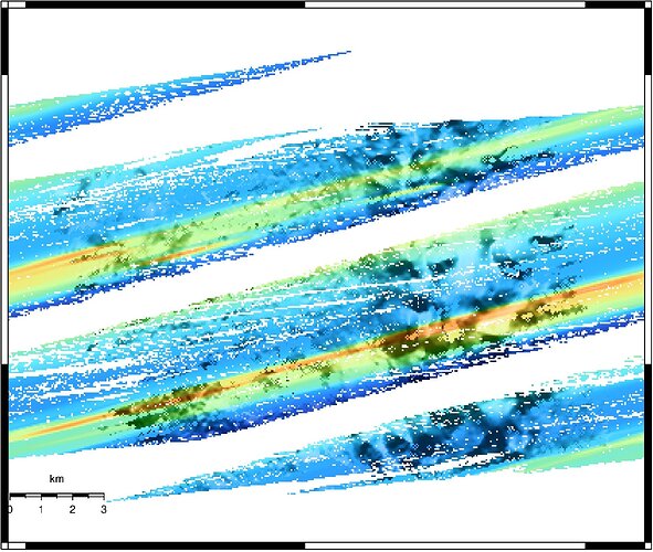
The same thing happens once I create the INT file. Therefore, the following image results:
If I check similar GeoTiffs, this problem does not occur, take a quick look:
strings -f ../*.tif.int | grep SPHEROID
../ap.tif.int:         SPHEROID["WGS 84",6378137,298.257223563,
../pd.tif.int:         SPHEROID["unknown",6378137,298.257223600004]],
../pp.tif.int:         SPHEROID["WGS 84",6378137,298.257223563,
../sp.tif.int:         SPHEROID["WGS 84",6378137,298.257223563,
I am still trying to check what it is going on with the GeoTiff files, but I would like to know if tools such as grdgradient or grdmath are able to wipe out this type of projection information from GTiff files, is it possible? I presume that it is not possible but still ask to be sure. I use GMT5.4.4.
Any suggestions are welcomed,
All the best,
Gery
