Dear GMT Comunity,
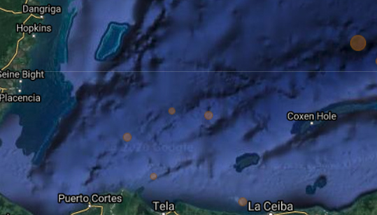
I am wondering if there is any why to mimic the “satellite layer” of Google Map or Google Earth? I tried to search any cpt template but haven’t really found it.
For instance, I found the ocean bathymetry of the Google Map much more accurate visually (I have etopo15 that I believe is no less accurate but I may not be using the best color template).
I attach a screenshot of bathymetry I’m trying to plot with GMT.
Would be very grateful if anyone can help.
Best,
Han

Maybe try using the Global Earth Day Images which uses NASA’s Blue Marble image, see Remote Data Sets — GMT 6.6.0 documentation.
It’s available via something like grdimage @earth_day_10m. You’ll need to set the -R (region) to your area of interest. Maybe try with shading on using the -I@earth_relief_10m flag for good measure.
This awesome! Just want to ask that is it feature only for GMT 6?
Best,
Han
The dataset yes. But for previous versions you can download the image yourself.
Many thanks! Really appreciate all the help.

