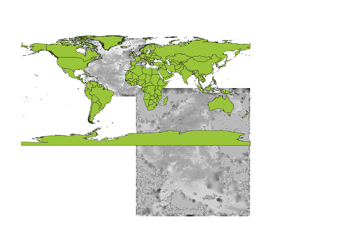
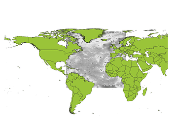
Hi, new to GMT so hopefully the issue here is straightforward. I have a table of xyz data and I’m trying to turn it into a surface. However, when I use surface (or xyz2grid) and increase the resolution above a certain amount the resulting surface loses its geo-referencing. I can’t find any threads regarding this issue, so any help would be greatly appreciated. Some pics of the issue and code below:
West=-80
East=15.5
South=-12
North=78

REGION=$West/$East/$South/$North
echo "Region: " $REGION

#Map Projection(Lat/Lon/Par1/Par2/Scale) -JB-35/90/0.5/59/15

Lat=-35
Lon=90
Par_1=0.5
Par_2=59
Scale=15

SCALE=B$Lat/$Lon/$Par_1/$Par_2/$Scale
echo "Scale: " $SCALE

echo 'Progress : GMT Georeferencing...'
# Georefs the .xy file using GMT
gmt mapproject thickness_with_nulls.csv -R$REGION -J$SCALE  -I \
| gmt blockmean Atlantic_Thickness.Trimmed.csv -I100k -R$REGION > blockmean_thickness_nulls.xyz

# Creates a grid of the above trimmed and deleted data points.
gmt surface Atlantic_Thickness_Points.csv -I100k -R$REGION -GAtlantic_Grid
~ -I100k the gridding works well and the geo-referencing is correct, below ~ I70k it spins as shown.
Cheers
!

