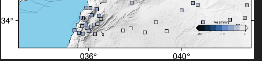
Also I can’t set up the font size of annotation, colorbar label, even I configure the config as below:
pygmt.config(
MAP_FRAME_TYPE=“plain”,
FONT_ANNOT_PRIMARY=“10p,Helvetica,black”, # ticks (axes + colorbar)
FONT_LABEL=“12p,Helvetica-Bold,black”, # labels (axes + colorbar +t/+l)
)