Hi, all
I use the grdcontour to plot the CLS_MSS (Mean sea surface) model which is in Netcdf format and has several parameters inside. Here is the contents of CLS_MSS:
   0    3   'LatLon'
   1    0 'NbLatitudes'
   2    1 'NbLongitudes'
   3    3 'LatLonMin'
   4    3 'LatLonStep'
   5    0      'mss'
   6    0  'mss_err'
The mss parameter is the parameter I want to use.
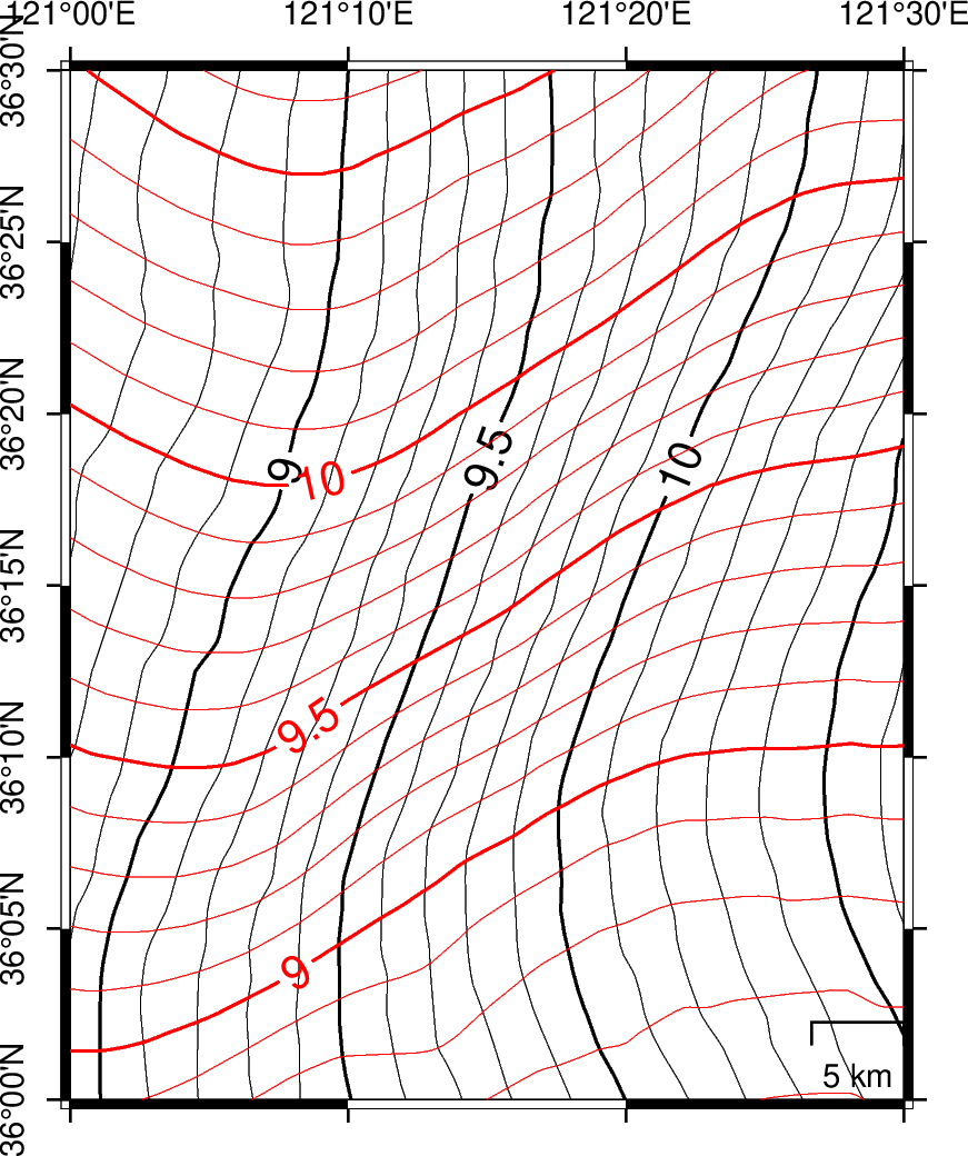
However, the figure seems wrong compared with the DTU MSS model. The contour lines are probably 90 degree rotation. In my mind, the GMT knows the Latitude and Longitude, so it should not produce such errors. So, very confused.
In addition, I found the CLS model can not be processed properly by the gdrcut.
For DTU model (only has Lat Lon mss), everything is good when using GMT.
The code is:
gmt psbasemap -R121:00/121:30/36:00/36:30 -JM2.5i -P -K -Bxa -Bya -BWNes --MAP_ANNOT_OBLIQUE=45  >qly.ps
gmt pscoast -R -J -O -K -Df -Lx6c/0.5c+c120/36+w5k  -W0.2p -A1000 -Glightyellow >>qly.ps
gmt grdcontour dtu.nc -R -J -C0.1 -A0.5+f10p -Gd2i -O -K -S4 -Wa0.6p,black -Wc0.1p,black  >> qly.ps
gmt grdcontour "mss_cnes_cls2015_20021231.nc?mss" -R -J -C0.1 -A0.5+f10p -Gd2i -O  -S4 -Wa0.6p,red -Wc0.1p,red >> qly.ps
DTU file:https://www.jianguoyun.com/p/DRbwelIQ2PCQBxjZ64QE
CLS file:https://www.jianguoyun.com/p/DVsALfoQ2PCQBxiR7IQE