Hi, everyone
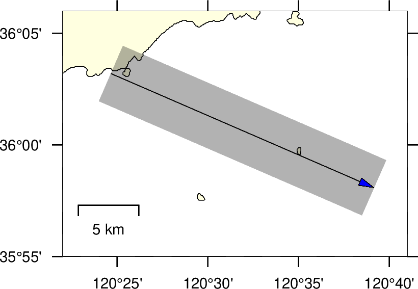
I hope to plot a line with width of 5km. Is there a simple way to do this job using GMT?
The figure will look like:
My method is not directly. I use the scale of map projection to do this.
#!/bin/bash
# This is the Fig 1

R=120:22/120:41/35:55/36:06
J=m120:30/36/1:500000
# Here use the map scale not the width in map projection. This will allow the line width in cm unit to link to the geographical units km.
gmt gmtset MAP_FRAME_WIDTH = 0.001c  FONT_ANNOT_PRIMARY	= 7p
PS=xmd.ps
gmt psbasemap -R$R -J$J -P -K  -Lx0.3i/0.3i+c120/36+w5k >$PS
gmt pscoast -R$R -J$J -O -Df -W -I1 -K -Bpxa5mf -Bpya5mf -BnWSe -Glightyellow >> $PS
echo 120.41099 36.053231 > tmp.d
echo 120.65269 35.968024 >>tmp.d
gmt psxy tmp.d -W1c,black -R$R -J$J -P -O -K -t70 >> $PS
gmt psxy tmp.d -W0.01c,black+ve0.1i+gblue -R$R -J$J -P -O   >> $PS

gmt psconvert $PS -A -P -Tg
rm gmt.* *.ps tmp*
