Hi,
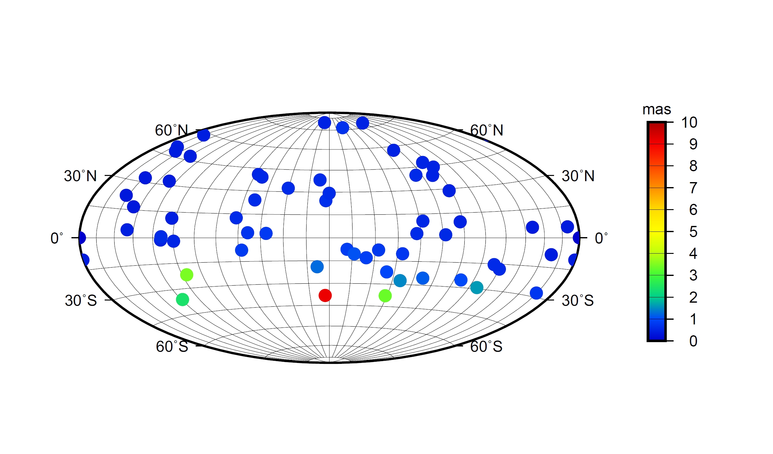
I have a set of radiosources with right ascention, declination, and error, and I would like to have a map similar to the one in:
But I would like to plot the “north” and “south” coordinates (I.e. 90S and 90N). The best script I wrote is the one below but I cannot see the X axis annotations like in the example. Is there a way to do that? I am uploading the map.
Unfortunately, we do not have a (simple) way to annotate inside the map as you would like. We have the same issue for polar projections where radial annotations are missing when the angular region is 360. I will start a feature request for how we may implement such a feature.
Meanwhile, a workaround would be to place those labels manually, e.g.,
gmt math -T-150/150/30 -N3/0 -C2 T = | gmt pstext -R -J -F+f10p >> DH.ps