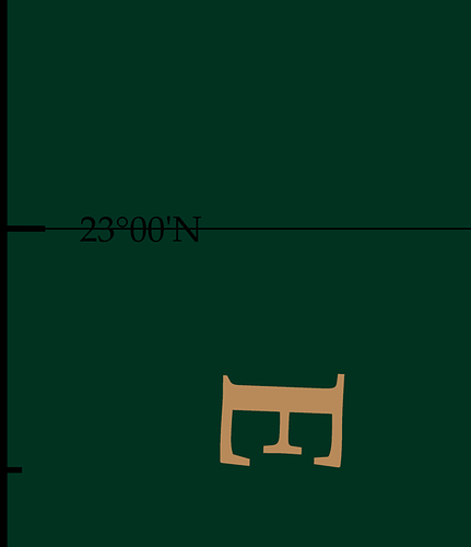
I’ve got a simple map with some custom gridlines. The gridlines go through the latitude and longitude labels. However, the lines go through the text. How can I adjust the labels to move lat slightly above the line and lon slightly next to the line. The config offsets in docs don’t seem to do that.
with pygmt.config(FONT=f"{size_scale*2}p,{FONT}",     MAP_FRAME_TYPE="inside", MAP_GRID_PEN_PRIMARY="0.1p,black"):
    fig.basemap(
        # justify='bl',
        region=region_map,
        projection="M12c",  # Mercator projection with a width of 12 centimeters
        frame=["af+s25p/25p/gray30", 'x1g1', 'y1g1']
    )
example image:
