Hi!
I am trying to plot focal mechanisms on a map with an offset. I’ve tried to follow the tips given here:
[ PyGMT: How to offset focal mechanism beachballs?]
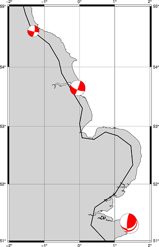
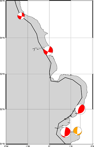
but still cannot get it to work, the two beachballs in the southeast are still plotted on top of each other, although there is no error message.
My file contains the columns
longitude latitude depth strike dip rake magnitude plot_longitude plot_latitude
and columns are separated by tabs:
|longitude|latitude|depth|strike|dip|rake|magnitude|plot_longitude|plot_latitude|
|1.4421|51.2819|15.5|47.28|32.05|112.09|4.5|1.4421|52|
|1.3884|51.3337|17|69.84|25.88|151.52|4.5|0.75|51.3337|
|-0.055|53.648|19.3|21.33|84.92|-19.37|4.1|-0.055|53.648|
|-1.314|54.594|4.6|102.1|84.1|-162|3.1|-1.314|54.594|
My code looks as follows:
Read ISC catalogue for plotting focal mechanisms
FM_ISCex=pd.read_csv(‘FM_ISC_exampleplot.txt’,delimiter=“\t”)
fig = gmt.Figure()
fig.coast(
region=“-2/2/51/55”,
projection=“M15c”,
land=“lightgray”,
water=“white”,
borders=“1/0.5p”,
shorelines=“1/0.5p”,
frame=“ag”,
)
fig.meca(
spec=FM_ISCex,
convention=‘aki’,
scale=“2c”,
G=‘red’,
offset=True
)
fig.show()
What am I still doing wrong?
Thanks a lot for any help, very appreciated!
Kind regards,
Daniela

