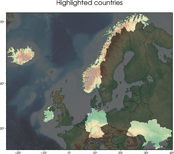
#!/usr/bin/env bash

# one or more comma-separated countries
# see https://docs.generic-mapping-tools.org/dev/coast.html#e
countries="NO,UA,IS,IE,DE"

gmt begin highlighted-countries png

gmt set GMT_THEME minimal

gmt grdimage @earth_relief_10m -JM20c -R$countries -t50
gmt coast -E$countries+C
gmt basemap -B+gblack@40
gmt coast -Q
gmt coast -Na -Baf -B+t"Highlighted countries"

gmt end
3 Likes
Is there a way to smooth the borders?
No, the DCW comes in one resolution.
What do you mean? To reduce the numbers of points that define the borders (i.e. to have a lower resolution line)?
Nah, more like a fuzzy contour (maybe some gaussian filtering near the border or something)
…Or just some shading using a slightly different -J, -X and -Y?
I think I don’t fully understand you. Would you share an example?
I thought I was doing groundbreaking stuff here. Guess not.
See also:
Yours is better 
1 Like
Thanks PlanetGus 
